Research
Habitat change for barren-ground caribou
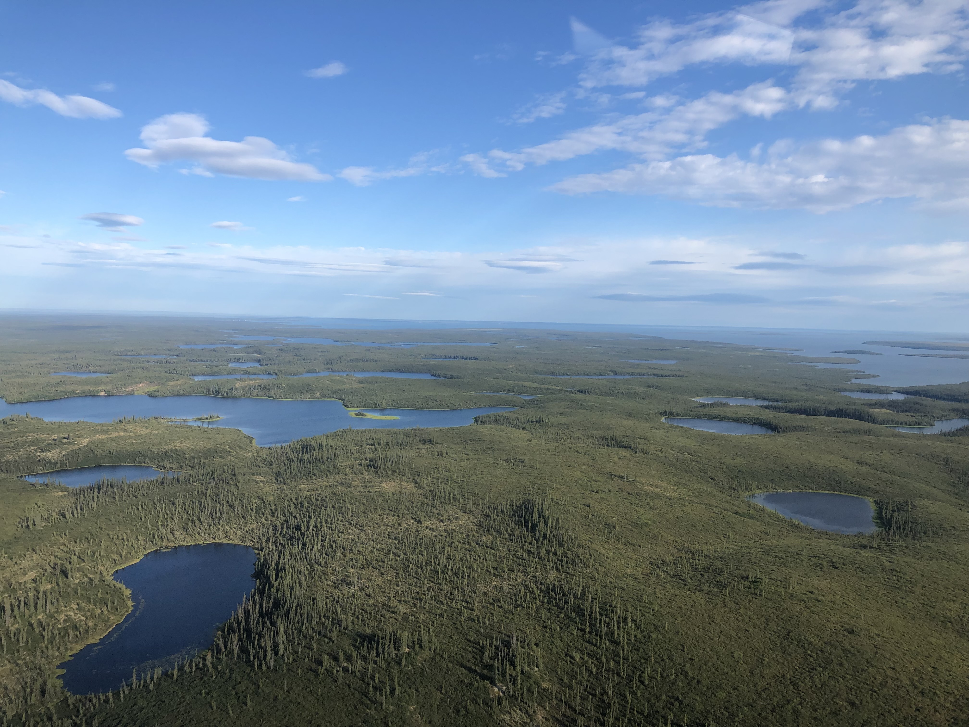
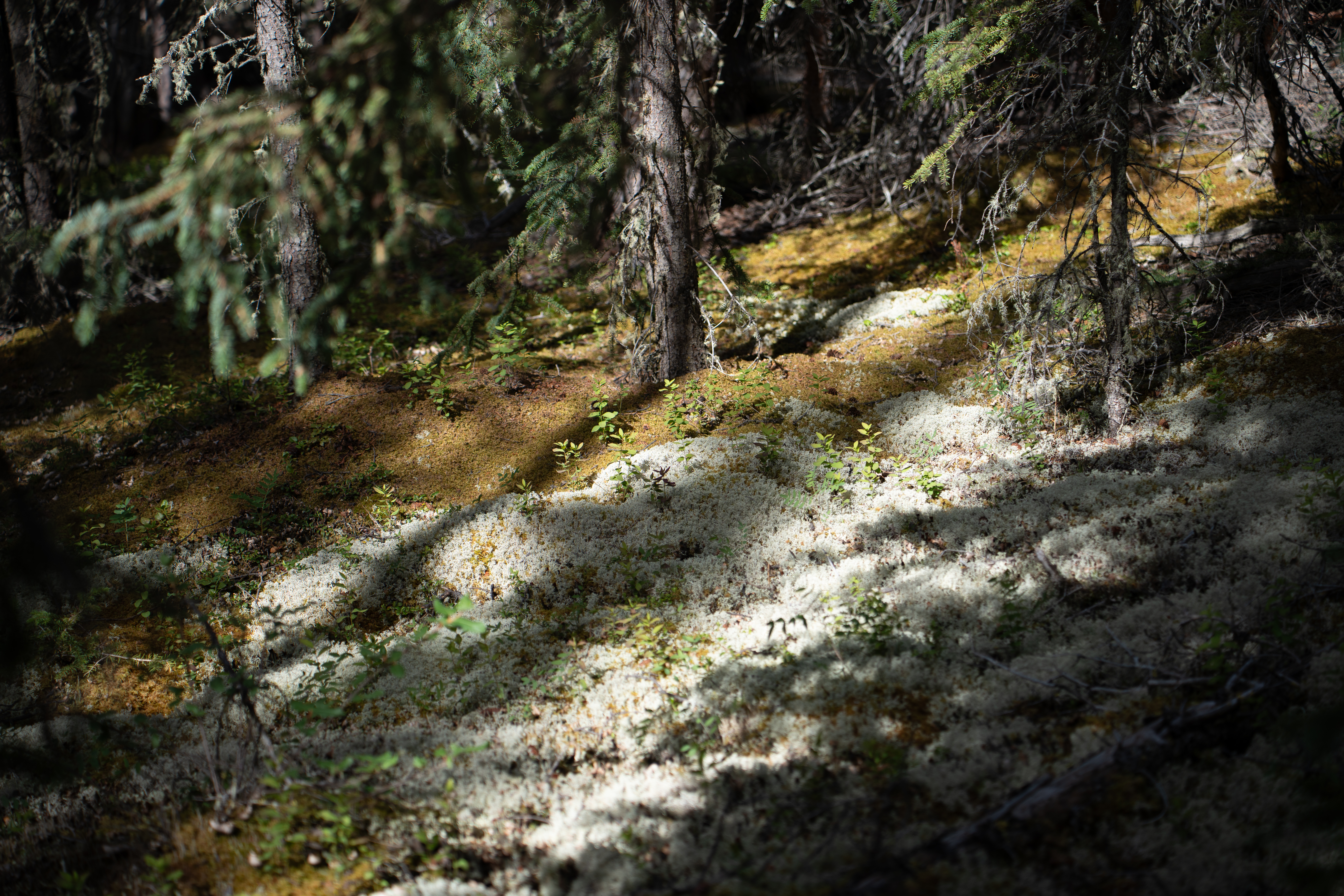
My current research focuses on changes in habitat quality for the Porcupine caribou herd in northern Yukon. In particular I am interested in mapping the cover of lichen patches that caribou depend on for their winter diet. Lichens grow very slowly and are extremely sensitive to disturbances like wildfires, taking up to 70 years to recover after being burned. They can also be outcompeted by shrubs that grow much more quickly and take up available space. Overall, lichen cover is decreasing across the tundra and northern boreal, and remaining lichen patches are getting smaller and more dispersed due fires and shrub growth. Overall, my research will explore the effects of disturbance and shrubification on caribou movement and habitat use.
Remote sensing of the northern treeline
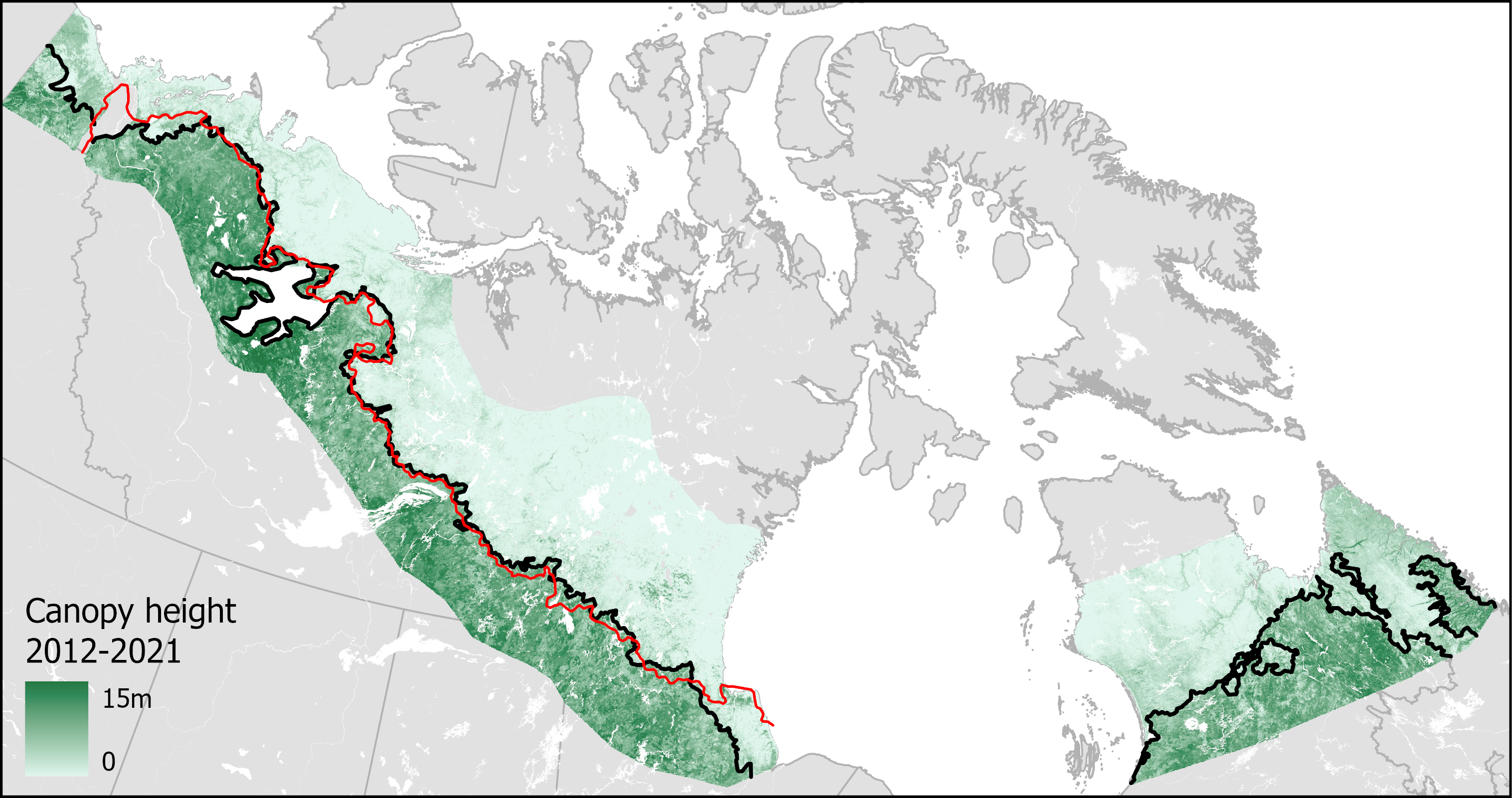
High-latitudes are experiencing some of the most rapid climatic changes on the planet. This is shifts in what types of plants can grow and how productive they are. My PhD research focused on using satellite remote sensing imagery from Landsat and ICESat-2 to model vegetation height and cover across the Canadian forest-tundra ecotone. I also used historical satellite images to map change in vegetation structure from 1985 to the present day and understand how the limit of northern boreal forests has responded to climate change. This research has important implications for habitat monitoring for a range of boreal and tundra wildlife.
Using drones to map carbon storage across treelines
Warming temperatures and changes in plant composition at the northern treeline can alter the amount of carbon stored in permafrost soils. My PhD research also used high-resolution drone imagery to map tree and shrub density and associate vegetation structure with soil organic carbon storage. We also use drone imagery to validate and understand better understand spectral patterns observed in moderate resolution satellite data. This field research was conducted north of Inuvik, NWT on the traditional territory of the Inuvialuit peoples.
.jpg)
Impact of permafrost thaw on tundra lakes
My MSc research focused on using satellite images to track changes in the number and size of lakes across the western Canadian Arctic. We also collected water samples to understand how permafrost thaw impacts water quality in different site types across the Tuktoyaktuk Coastlands and the Mackenzie River Delta, NWT.